Augmented Reality Overlay
The Client
Ngāi Tahu Property is a leading New Zealand property development, property management and investment company. As one of the investment pillars of Ngāi Tahu Holdings, their portfolio includes residential, industrial, and commercial developments in Christchurch, Queenstown, and Auckland. As part of Ngāi Tahu Property’s mission to create wealth for their Whānau; personal integrity, and respect and acknowledgement of their cultural heritage form the foundation of their values.
Client
Ngāi Tahu PropertyServices
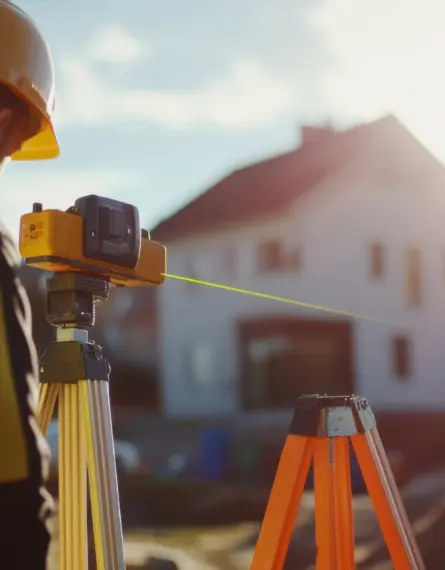
- Land Surveying
The Challenge
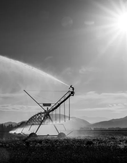
In 2018 we were working with Ngāi Tahu Property on the Tower Junction commercial building addition in Addington, Christchurch. We were undertaking some time-lapse aerial photography and videos of the development using Unmanned Aerial Vehicles (UAVs).
Ngāi Tahu Property’s marketing department had approached us to see how we could assist in the marketing of their developments. We have worked with Ngāi Tahu Property for decades on a variety of projects and they were familiar with our expertise in UAV surveying techniques and our ability to digitally illustrate the data. Following on from the time-lapse video, our survey team offered to overlay Ngāi Tahu Property’s digital illustration of the site’s boundary over our UAV footage as an add on service to the client.

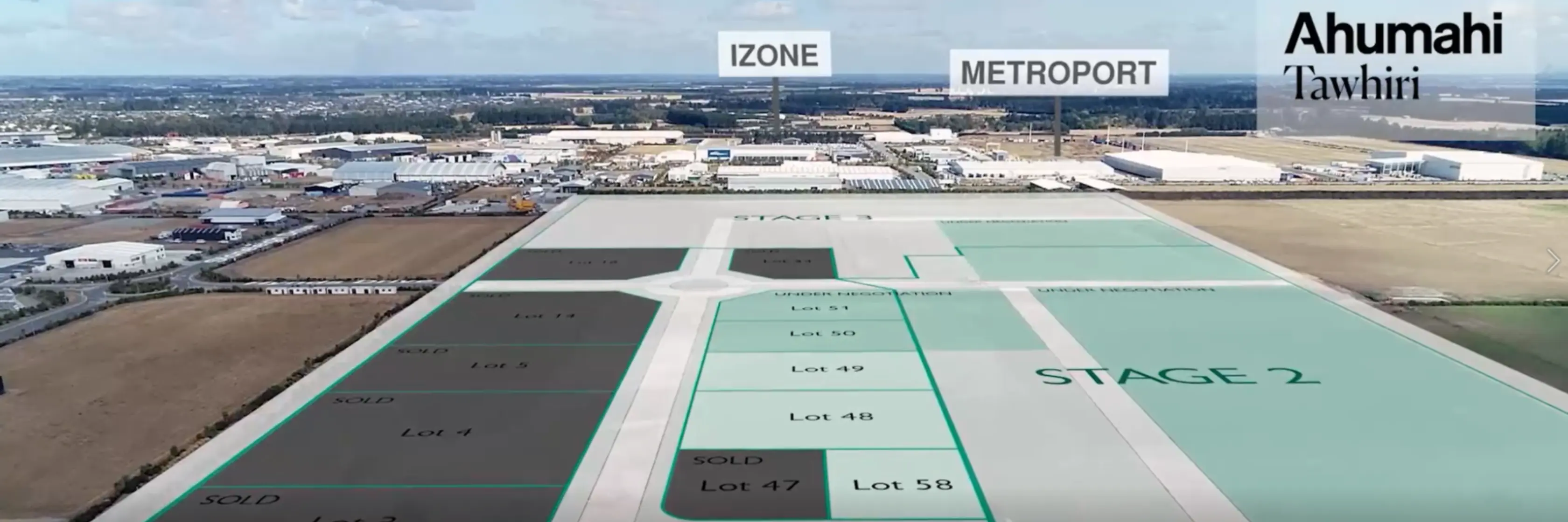
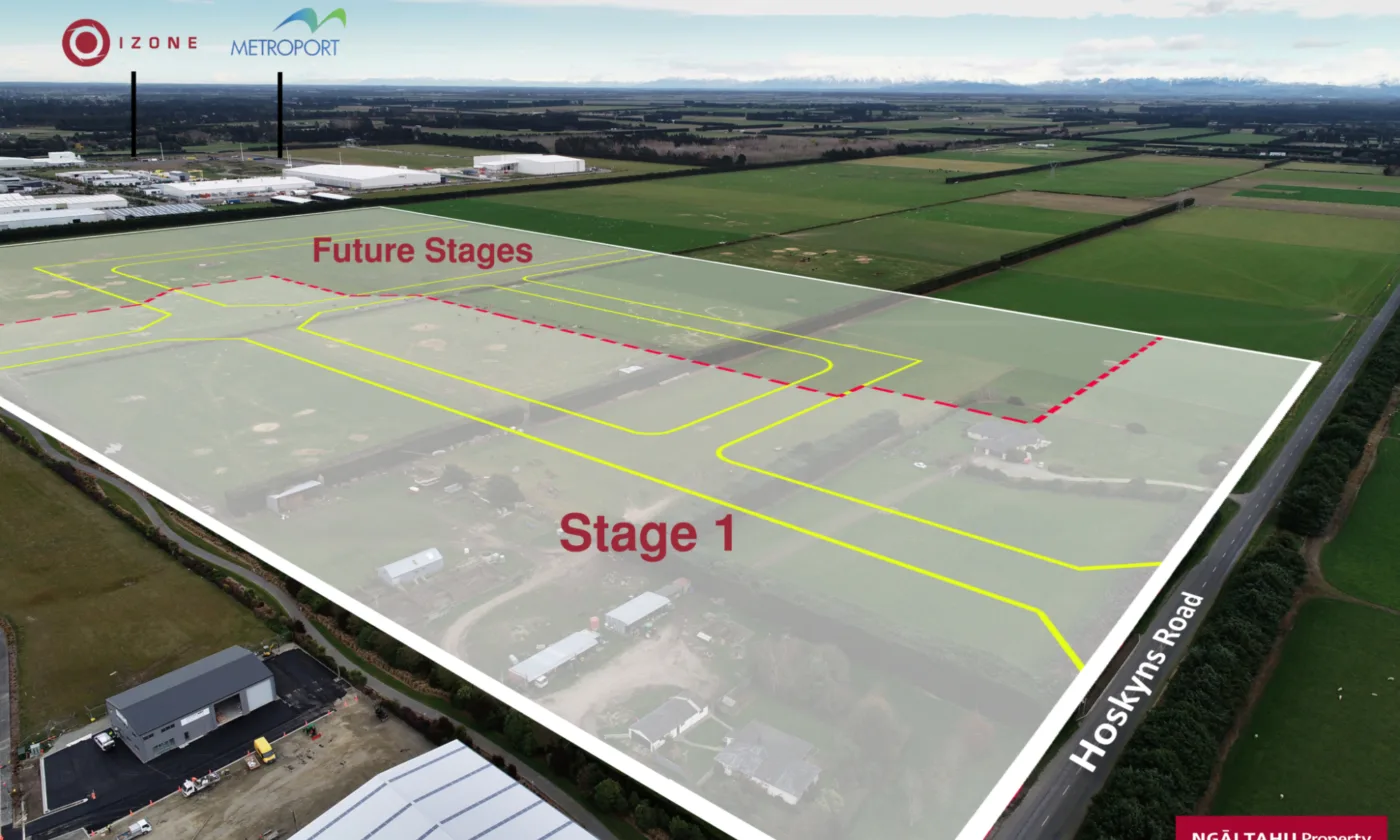
This became a joint initiative and the result was a set of augmented reality files illustrating the location of the lots in relation to the existing surrounding environment. Our client saw the marketing value in demonstrating how their development would appear in the real world. We have since provided similar augmented reality overlay videos and images for Ngāi Tahu Property for their Tawhiri, Kairua and Mānia developments.
The Solution
After our survey team have provided a subdivision layout, Ngāi Tahu Property’s marketing department create a sales plan for the site including the lot numbers and boundaries to use for their marketing purposes. We use this 2D digital file and transform it within our specialist software to geolocate the design relative to the physical location on the site, whilst creating a transparency so the design layout can be viewed in relation to the surrounding background.
We have created both still images and video AR overlays for our client. The video is more challenging as the camera is continually moving but the design needs to stay in the same place relative to the site. Our commercially certified UAV pilots have to ensure they calculate a flight path that will provide the optimum view of the surrounding neighborhoods while keeping the design of the development in view.
This process is incredibly versatile and has many applications. We can use augmented reality overlays to demonstrate proposed projects such as vertical construction for the purpose of resource consents (shadow analysis, recession planes) or illustrating how a proposed development or construction would fit on a site in relation to the surroundings.
The work we have done with Ngāi Tahu Property has given them a point of difference in marketing their developments. As the overlays are based on augmented reality rather than in a virtual design space, they graphically present how the development fits into the real world.
We have created both still images and video AR overlays for our client. The video is more challenging as the camera is continually moving but the design needs to stay in the same place relative to the site. Our commercially certified UAV pilots have to ensure they calculate a flight path that will provide the optimum view of the surrounding neighborhoods while keeping the design of the development in view.


Related Insights
Land Survey for Building a House in NZ
09 Apr 2026
Most people start their home-building journey…

International Women’s Day 2026 | Christchurch
24 Feb 2026
Eliot Sinclair is proud to host our third annual…

Christchurch Development Contributions Policy 2025
12 Sept 2025
Christchurch City Council has finalised the…