Land Surveying
Comprehensive Land Surveying Services Across New Zealand
With over 90 years of experience, Eliot Sinclair delivers precise and reliable land surveying solutions tailored to your project’s needs.
Whether you’re developing land, subdividing a property, or need certified spatial data for design and construction — accurate land surveying is critical. At Eliot Sinclair, we offer a full range of land surveying services to support residential, commercial, and infrastructure projects across New Zealand. Our licensed surveyors combine deep local knowledge with advanced geospatial technology to ensure every measurement is precise, every boundary is clear, and every project is set up for success.

Our Full Range of Land Surveying Capabilities
We offer a comprehensive range of surveying services to support everything from small-scale developments to large infrastructure and environmental projects. Below are the key areas where our licensed surveyors can help.
Title and Boundary Services
Accurate title definition and boundary resolution for legal clarity and council compliance.
- Boundary marking (e.g. fencing, rebuilds, post-earthquake)
- Easements and covenant areas
- Unit titles
- Cross lease updates and conversions
- Uplifting of Limitations on Titles
- Legalisation surveys (e.g. public works, road stopping)
Subdivision & Land Development
End-to-end support for residential, commercial, and rural subdivisions.
- Urban and rural subdivisions
- Land development surveying
- Scheme plans for consent applications
- Title plan preparation and certification
- Consultation for cross lease to freehold conversion
Construction & Building Surveys
Precise spatial data for site planning, construction, and certification.
- Building set out surveys (BSC)
- Building location certificates (BLC)
- Building lease area surveys (BOMA)
- As-built surveys
- Height in relation to boundary (HRB) checks
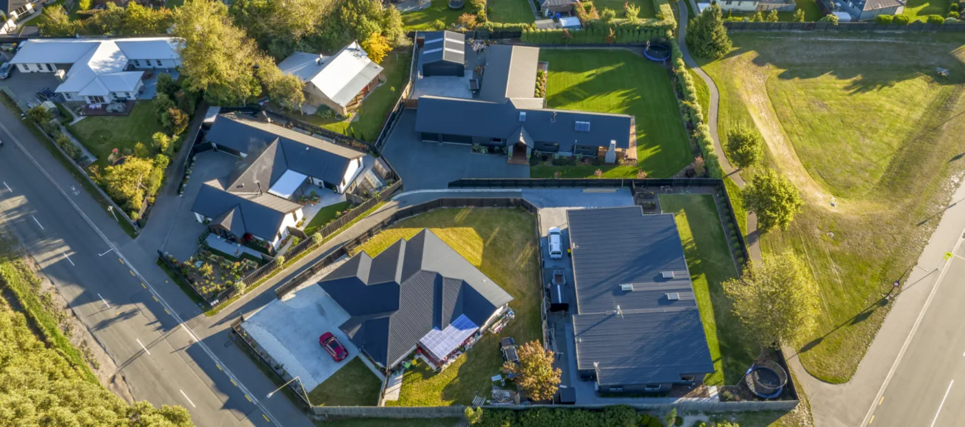
Topographic, Drone & 3D Scanning
Accurate terrain and 3D data for mapping, modelling and site analysis.
- Topographical/mapping surveys
- UAV (drone) aerial mapping surveys
- Point Cloud / 3D Laser scanning surveys
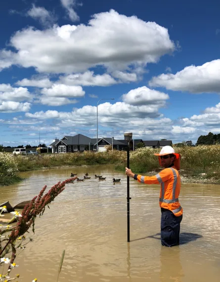
Environmental & Hydrographic Surveys
Support for projects involving water bodies, terrain shifts, and natural environments.
- Hydrographic surveys (rivers, lakes, coastal)
- Accretion claims
- Monitoring and deformation surveys
- Volumetric surveys and earthworks tracking
What is Land Surveying?
At its core land surveying is the art of measuring and mapping the environment and cadastre using specialised technology, techniques and knowledge. At Eliot Sinclair, we cover all aspects of survey measurements, from land and air to water, using advanced tools and highly skilled professionals. Our services include creating new land titles from subdivisions, producing clear plans and maps, and delivering digital 3D models and spatial data for development projects. With a team of experienced registered and licensed surveyors, we ensure every survey project meets the highest standards of accuracy and quality. Our innovative techniques, including laser scanning and UAV (Drone) surveys provide precise and comprehensive data to support your project needs.


Testimonial | Enterprise Homes

“We have no hesitation in recommending their services”
“Our company has utilised the services of Eliot Sinclair for over 50 years on many Residential Subdivisions in and around Christchurch. We have no hesitation in recommending their services in all the fields we have had to utilise, including urban design, planning, surveying, engineering and landscape architecture. The service that we have received including the ability to complete is exemplary”
Rob Sloan | General Manager | Enterprise Homes
Frequently Asked Questions (FAQs)
How much does a land survey cost NZ?
The cost of a land survey in New Zealand depends on the survey type, site conditions, and the detail needed. Generally, marking existing boundaries for fencing purposes starts at around $1,500+gst and boundary verification surveys start at around $900+gst, while a site (topographic) survey typically starts at around $1,500+gst.
There are many factors that could increase the cost such as location, extent of survey, age of underlying surveys, dense vegetation and titles that are limited as to parcels. Please contact our team for an accurate quote for your site and requirements.
For a full breakdown of survey types and their cost, visit the Property Survey Costs Explained article.
What is a boundary survey?
A boundary survey, also known as a property survey, accurately identifies and marks the exact location of property boundaries, corners, and property lines. It's commonly required for fencing purposes, resolving disputes, clarifying property ownership, or complying with legal regulations.
How do I find my property boundary line?
To find your property boundary in New Zealand, check your property title and survey plan available from Land Information New Zealand (LINZ) or a licenced/cadastral surveyor. If boundary markers are unclear or missing, you'll need to hire a licensed cadastral surveyor to identify and mark the boundaries clearly.
How long does it take to process a land survey?
A land survey typically takes anywhere from several weeks to a few months to complete in New Zealand. The timeframe depends on survey complexity and how long it takes for LINZ to review and approve the survey documentation.
What can I expect from a land survey?
A land survey provides accurate information on property boundaries, land elevations, structures, and any existing easements. You'll receive detailed maps and reports that clearly outline your property's characteristics and measurements.
What happens after a land survey is completed?
Once the survey is completed, the surveyor compiles the data into an official report and map (plan). These documents are then delivered to you or your property/legal professional for use in property conveyancing, construction planning, or legal proceedings.
Latest land surveying insights


Talk to us today
Our services

Land surveying careers

Shaping a better tomorrow for you.
A career in land surveying at Eliot Sinclair is rewarding with a great team behind you. If you are interested in joining our team, you can browse through our current vacancies and apply for a role with us through our careers page.