What a GIS Specialist Does: Why Their Work Matters
Ever wondered who creates those intricate maps you see online or how city planners decide where to build new infrastructure?
The answer often lies with GIS specialists. These professionals are the unsung heroes who use Geographic Information Systems to analyse spatial data and provide valuable insights for a wide range of industries.
From environmental conservation to urban development, GIS plays a crucial role in shaping the world around us.
20 Nov 2025 | 4 min read
Understanding GIS and Its Importance

What is Geographic Information System (GIS)?
A Geographic Information System, or GIS, is much more than a digital map. It is a technology that captures, stores, analyses, and manages spatial data to help us understand how places, people, and environments connect.
Think of it as a powerful database that combines spatial data with descriptive information, allowing GIS specialists to visualise patterns, relationships, and trends that would be impossible to discern from traditional maps.
GIS software allows you to overlay different datasets, like population density, elevation, and infrastructure, to understand their relationships.
In practice, GIS helps us make sense of the world in a spatial way. It turns complex data into clear insight and supports better decision-making in planning, design, and environmental management.
The Role of GIS in Various Industries
The applications of GIS stretch across almost every industry. In environmental science, it helps monitor deforestation, track wildlife movements, and analyse changes in air and water quality. Urban planners use spatial data to optimise transport networks, guide new developments, and manage resources more efficiently.
Businesses also rely on GIS for market analysis, site selection, and logistics planning, using location data to make informed strategic decisions. Across these fields, GIS professionals play a vital role in turning complex datasets into practical insight.
Their expertise supports better outcomes in planning, design, and environmental management, and continues to drive demand for skilled specialists in this evolving field.
What are the Benefits of using GIS Technology
The benefits of using GIS technology are wide-ranging and apply across many disciplines. Integrating GIS into projects helps to:
- Improve decision-making by providing clear, visual representations of complex spatial information.
- Increase efficiency through streamlined data analysis and automated workflows.
- Enhance communication by creating maps and models that are easily understood by stakeholders.
From coordinating emergency responses to managing natural resources sustainably, GIS provides the clarity needed to make informed, evidence-based decisions.
At Eliot Sinclair, GIS is an integral part of how we plan, design, and deliver projects. Our specialists use spatial data to uncover insights that guide smarter, more sustainable outcomes.
Day in the Life of a GIS Specialist

Typical Responsibilities of a GIS Analyst
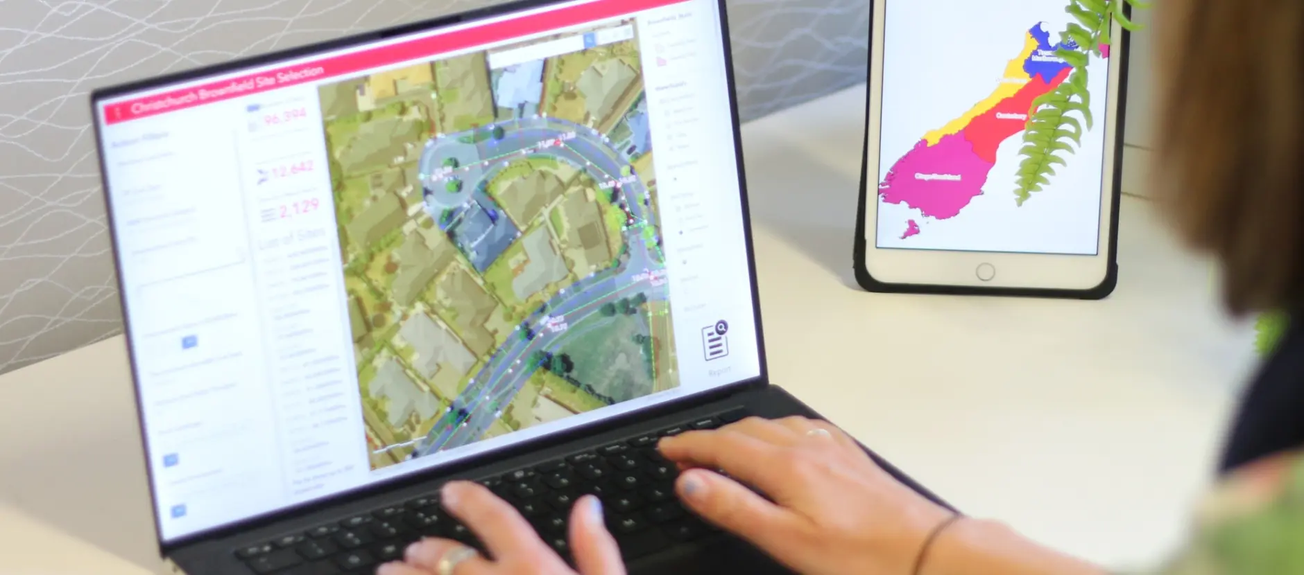
The work of a GIS specialist is diverse and dynamic. A typical day may include creating maps, building spatial models, and performing complex geospatial analysis. Using GIS software, analysts manage and interpret data to extract insights that support a wide range of projects.
Their work often spans sectors such as urban planning, environmental science, and infrastructure development. They may also assist legal and property teams by mapping boundaries, assessing environmental risks, and providing spatial data to support decision-making.
Day-to-day tasks can include maintaining databases, integrating satellite imagery, and presenting findings to stakeholders, ensuring that spatial data remains accurate, reliable, and meaningful.
Tools and Software Used by GIS Specialists
GIS specialists rely on a range of tools to capture, process, and analyse spatial data.
- ArcGIS – a leading platform that provides advanced capabilities for mapping, analysis, and data management.
- FME - a data integration platform that transforms, converts, and automates spatial and non-spatial data workflows.
In addition to these core platforms, GIS professionals often use GPS devices, drones, and satellite imagery to collect and verify data. Proficiency in these tools is essential for anyone pursuing a career in GIS, as they enable analysts to integrate and interpret spatial information effectively.
Challenges Faced in the Field
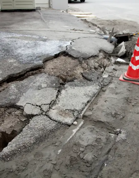
The path of a GIS specialist isn't always smooth. Dealing with inaccurate or incomplete geospatial data is a common challenge, requiring meticulous data cleaning and validation.
Integrating data from various sources and formats can also be tricky.
Additionally, keeping up with the rapid advancements in GIS technology and software requires continuous learning.
Despite these challenges, the rewards are significant. GIS specialists play a key role in transforming data into knowledge that supports better planning, design, and environmental outcomes.
Becoming a GIS Specialist

Required Education and Qualifications
If a career as a GIS specialist appeals to you, you'll need a solid educational foundation. A bachelor's degree in geography, environmental science, or a related field is typically required for GIS positions. Specifically, beneficial coursework may include:
- Cartography
- Spatial analysis
- Database management
Many employers also seek candidates with experience using GIS software like ArcGIS. Developing strong analytical and problem-solving skills is crucial, as you'll be working with complex datasets and interpreting spatial relationships. If you're looking to become a GIS specialist, you need to gain the relevant qualifications.
Certification Options for GIS Professionals
While not always mandatory, professional certifications can significantly enhance your credentials as a GIS professional.
The GIS Certification Institute (GISCI) offers the Certified GIS Professional (GISP) designation, which validates your knowledge, experience, and ethical conduct in the field of GIS.
Pursuing certification is a worthwhile investment for those aiming to advance their GIS career. It signals a commitment to professional growth and can lead to improved job prospects and higher earning potential.
Gaining Professional Experience in GIS
Practical experience is key to building a successful GIS career. Internships and co-operative education programmes provide valuable exposure to real-world projects and tools. Volunteering on GIS initiatives or contributing to open-source mapping projects can also strengthen your portfolio.
Networking with GIS professionals through conferences, workshops, and online communities helps build connections and uncover job opportunities. As the demand for spatial data continues to grow, gaining hands-on experience remains one of the most effective ways to build a rewarding career in GIS.
GIS Careers and Job Outlook

Popular Job Titles for GIS Professionals
Careers in GIS cover a wide range of roles. Common positions include:
- GIS Analyst – responsible for spatial analysis, mapping, and data interpretation.
- GIS Technician – focuses on collecting, maintaining, and producing geographic data and maps.
- Geospatial Specialist – applies GIS tools and data to solve real-world planning, design, and environmental challenges.
Each role requires a slightly different skill set, but all share the goal of using geographic information to support informed decision-making. Skilled GIS professionals remain in high demand across multiple industries.
GIS Specialist Salary Expectations
One of the appealing aspects of a GIS career is its strong earning potential and clear progression with experience. In New Zealand, salaries vary depending on role, experience, and location.
According to Careers New Zealand, geospatial and GIS specialists typically earn:
- Entry-level or graduate roles: around NZD 49,000 – 65,000 per year
- Mid-level positions (5+ years): around NZD 60,000 – 80,000
- Senior or management roles: between NZD 70,000 – 120,000+, depending on project complexity and sector
These figures reflect base salaries and may increase with certifications, advanced technical skills, or leadership responsibilities.
Urban centres and industries that rely heavily on spatial data, such as infrastructure, environmental management, and urban planning, tend to offer higher salaries.
As GIS continues to expand across sectors, opportunities for career growth and competitive remuneration remain strong.
Future Demand for GIS Specialists
The future for GIS specialists is promising. As technology evolves, so too does the need for professionals who can manage, analyse, and interpret spatial data. Fields such as environmental science, resource management, and urban planning increasingly depend on accurate geospatial information to inform decisions and optimise outcomes.
With demand for reliable spatial data continuing to rise, GIS expertise has never been more valuable. For those interested in joining the field, now is an ideal time to begin building skills in geospatial analysis and data management.
Eliot Sinclair's GIS Expertise
How Eliot Sinclair Can Support Your GIS Needs
At Eliot Sinclair, we understand the value of spatial data and how it can transform projects. Our GIS team provides comprehensive solutions, from data acquisition and analysis to visualisation and reporting, to help our clients integrate GIS technology into planning, design, and environmental decision-making.
Whether you are working in infrastructure, resource management, or urban planning, our specialists can help you unlock the full potential of geographic information systems.
Connecting with Our GIS Specialists
Ready to explore how GIS can support your next project? Connect with our team of GIS professionals at Eliot Sinclair. We tailor our approach to align with your project goals, ensuring accuracy, insight, and meaningful results.
Whether you need assistance with spatial analysis, map creation, or integrating GIS software into your workflow, our experts are here to help.