Why Georeferencing Matters in GIS
Georeferencing matters in GIS because it ensures spatial data is accurately aligned to real-world locations. Without it, maps may look correct at a glance, but the information behind them can be misleading, inconsistent, or unusable for analysis and decision-making.
05 Mar 2026 | 4 min read
In a Geographic Information System, every dataset needs a shared spatial reference. Aerial imagery, survey data, boundaries, infrastructure layers, and environmental constraints only work together when they are tied to the same coordinate system and geographic framework. Georeferencing is what makes that possible.
When data is correctly georeferenced, GIS can be trusted to support planning, design, and analysis. When it is not, even small alignment errors can lead to incorrect overlays, flawed assessments, and poor decisions downstream.
This article explains what georeferencing is, why it plays such a critical role in GIS, and what can go wrong when it is overlooked or handled incorrectly.
What Is Georeferencing in GIS?
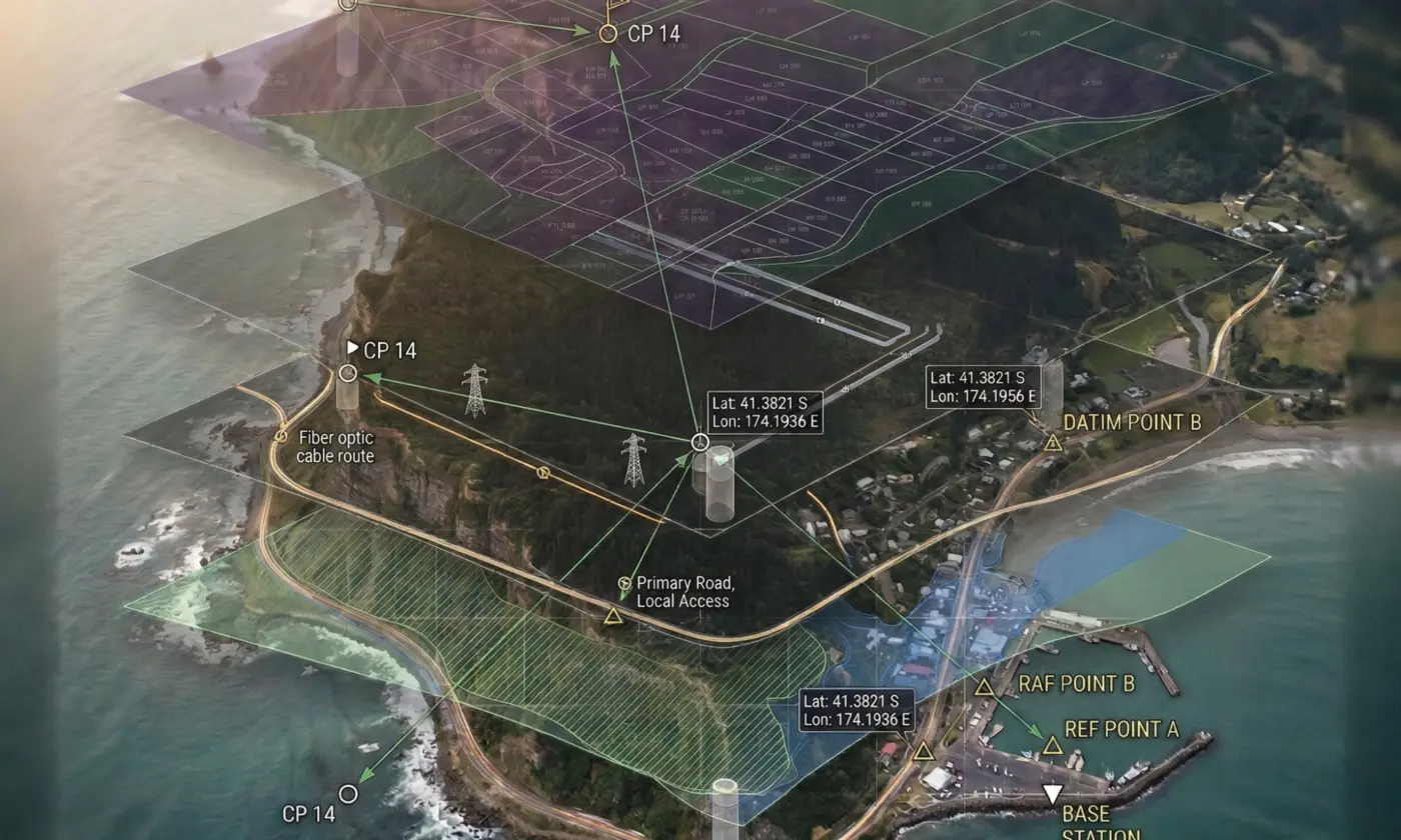
Georeferencing is the process of assigning real-world geographic coordinates to a dataset so it can be accurately placed on the Earth’s surface within a GIS.
In simple terms, it answers one fundamental question: where is this data located in the real world?
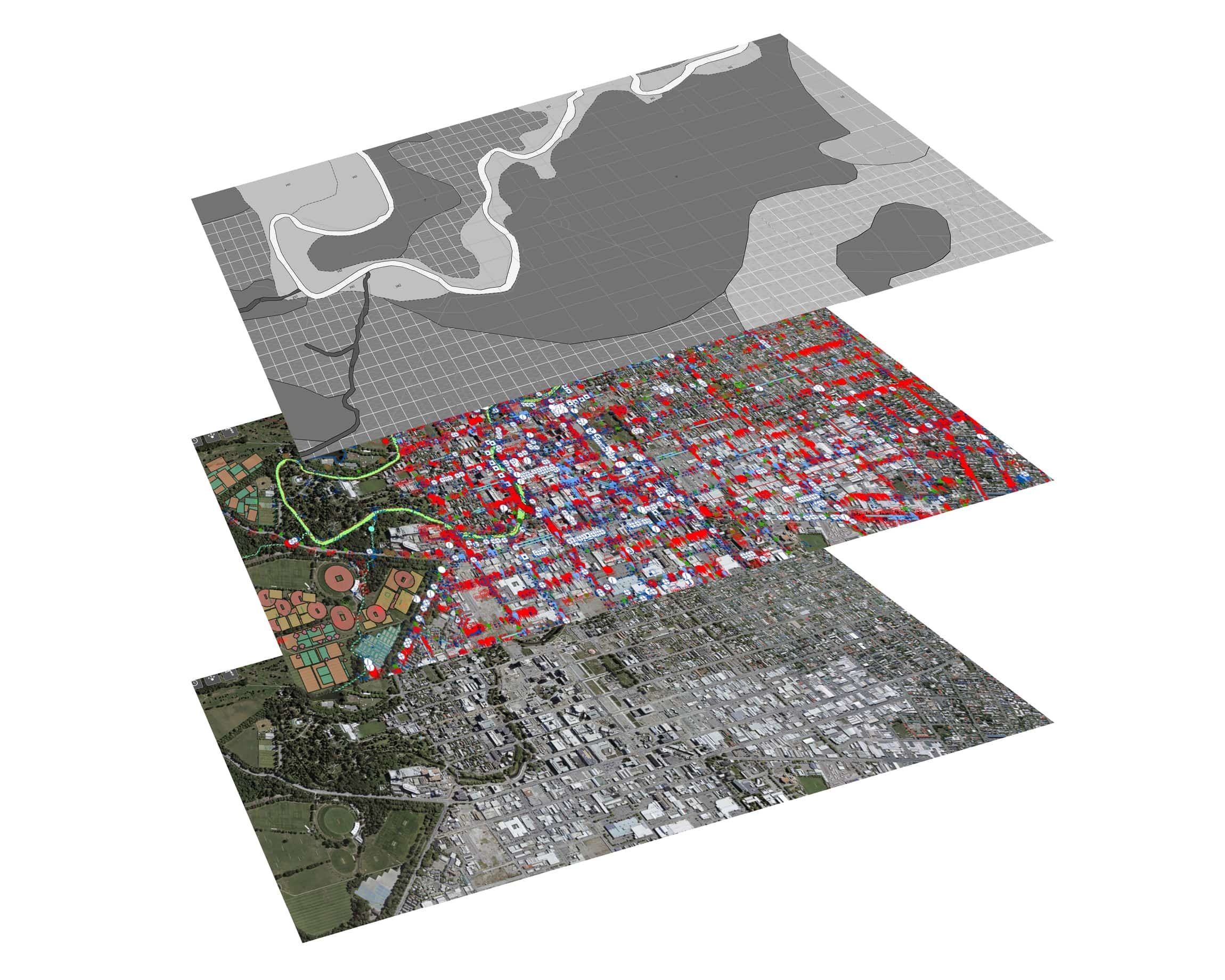
When a dataset is georeferenced, every point, line, or pixel is tied to a known coordinate system, such as latitude and longitude or a projected grid. This allows different layers, such as aerial imagery, survey data, boundaries, and infrastructure, to align correctly and be analysed together.
Without georeferencing, GIS data has no reliable spatial context. A map may still display on screen, but its position is effectively arbitrary. It cannot be accurately overlaid with other datasets, measured with confidence, or used to inform spatial decisions.
How Georeferencing Works in Practice
Georeferencing typically involves linking a dataset to known control points or spatial references. These might include:
- Survey control marks
- Known boundary corners
- Road intersections
- Recognisable features visible in aerial imagery
By matching these reference points to their correct coordinates, the dataset can be transformed so it fits precisely within the GIS environment.
Once this process is complete, the data behaves as expected. Distances can be measured accurately, layers align correctly, and spatial relationships can be analysed with confidence.
Why Accurate Georeferencing Underpins GIS Analysis
Accurate GIS analysis depends on one assumption: that every dataset is correctly positioned in relation to the real world and to each other. Georeferencing is what makes that assumption valid.
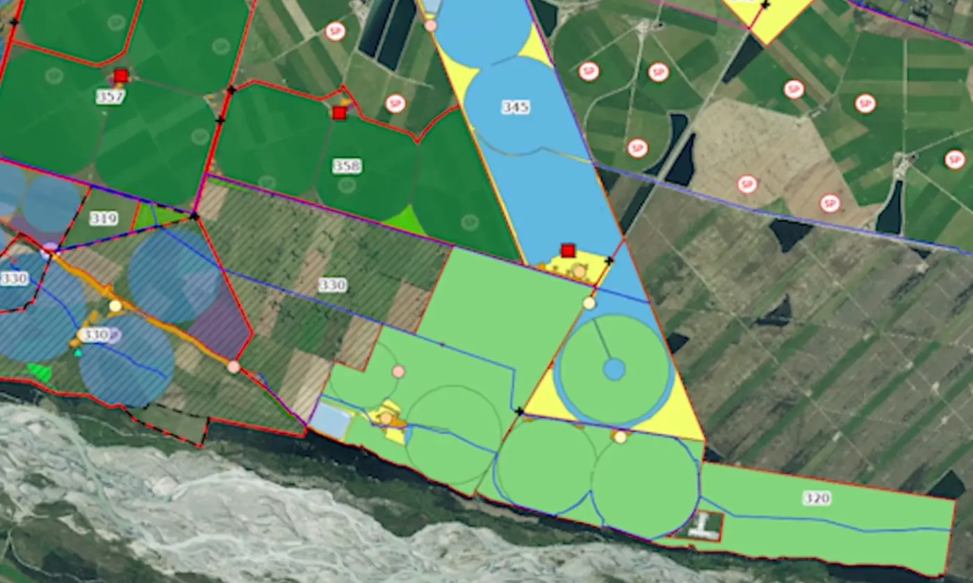
When data is properly georeferenced, different layers can be overlaid with confidence. Property boundaries align with aerial imagery. Infrastructure sits where it should. Environmental constraints intersect accurately with land parcels. This spatial consistency is essential for meaningful analysis.
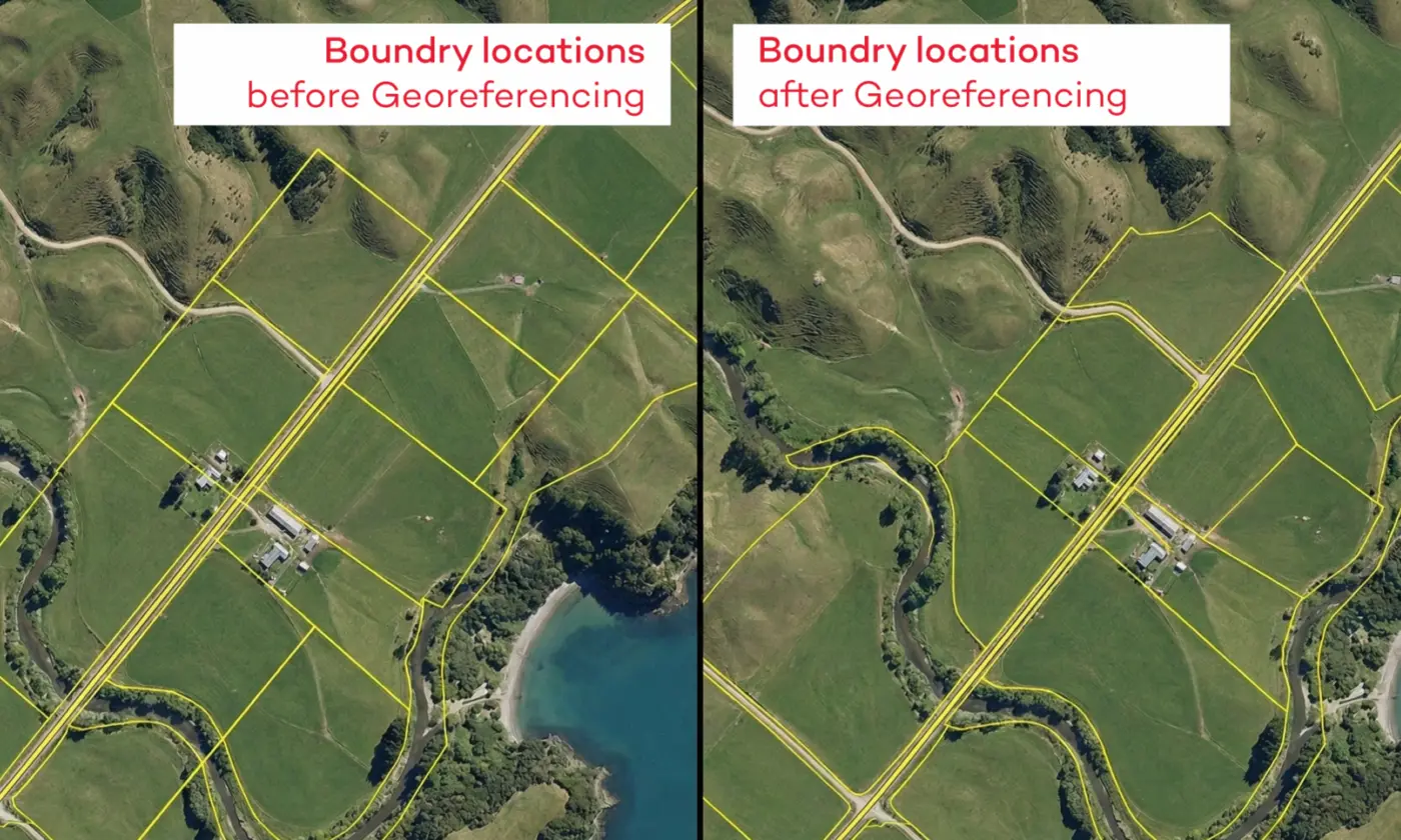
If georeferencing is incorrect or inconsistent, even by a small margin, the results can be misleading. Layers may appear close enough at first glance, but subtle shifts can distort measurements, misrepresent relationships, and lead to incorrect conclusions.
What Happens When Georeferencing Is Done Poorly
In practice, poor georeferencing can result in:
- Boundaries that do not line up with aerial imagery
- Infrastructure appearing offset from its true location
- Incorrect distance, area, or proximity calculations
- Misidentification of constraints or overlaps
These issues are not always obvious immediately. A map may still look professional and visually convincing, which makes the risk higher.
The result of this is that decisions can be made based on flawed spatial relationships without anyone realising there is a problem.
Why Consistency Matters Just as Much as Accuracy
Georeferencing is not just about assigning coordinates once. It is about ensuring all datasets use a consistent spatial reference framework.
Mixing data from different coordinate systems, datums, or projections without proper transformation can introduce alignment errors that compound as more layers are added. Over time, this erodes confidence in the GIS as a decision-support tool.
Reliable GIS analysis depends on consistency. When every dataset shares the same spatial reference, GIS can be used to compare, model, and assess information with confidence.
Common Georeferencing Issues and Mistakes
Many georeferencing issues do not come from obvious errors. They come from datasets that appear close enough, legacy information that lacks proper spatial references, or workflows where consistency is assumed rather than checked. Over time, these small issues can compound and undermine confidence in the GIS as a whole.
Here are some examples...
1. Using Data with Unknown or Incorrect Coordinate Systems
One of the most common problems is working with data where the coordinate system is missing, incorrectly defined, or simply assumed.
If a dataset’s spatial reference is wrong, every layer it is compared against will be misaligned. The map may still display, but its position relative to other data is unreliable. This is particularly common with older datasets or files sourced from multiple organisations.
2. Mixing Coordinate Systems Without Proper Transformation
Another frequent issue is combining datasets that use different coordinate systems or datums without applying the correct transformations.
Even when two datasets appear to use similar projections, small differences can result in noticeable alignment errors. As more layers are added, these offsets become harder to trace and can distort analysis results.
3. Poor Selection or Inconsistent Use of Control Points
When georeferencing imagery or scanned plans, the choice and placement of control points matters.
Using too few control points, relying on poorly defined features, or placing them inconsistently across a dataset can introduce distortion. The data may align in one area but drift in another, creating a false sense of accuracy.
4. Assuming Visual Alignment Means Spatial Accuracy
A map that looks right is not always spatially correct.
It is common for datasets to appear aligned at certain scales, especially when viewed on screen, even when they are not accurately georeferenced. This visual reassurance can mask underlying errors that only become apparent when measurements, overlays, or proximity analysis are performed.
5. Compounding Errors Over Time
Georeferencing issues rarely exist in isolation.
When misaligned data is reused, shared, or built upon, errors propagate. Over time, this makes it difficult to identify the original source of the problem and increases the risk of decisions being made on flawed spatial information.
Conclusion
Georeferencing is not just a technical step in a GIS workflow. It is what determines whether spatial data can be trusted to support real decisions.
When datasets are accurately and consistently georeferenced, GIS becomes a reliable tool for understanding land, infrastructure, and constraints. When it is not, even well-presented maps can mislead, creating risk rather than clarity. The difference is often not obvious at first glance, which is why good georeferencing practice matters from the outset.
For planning, land development, and infrastructure projects, spatial accuracy underpins everything that follows. Boundaries, constraints, services, and environmental layers all depend on being correctly aligned in the same geographic framework. Small errors introduced early can compound as data is reused, shared, or built upon.
At Eliot Sinclair, georeferencing is treated as a foundation, not an afterthought. Our work in GIS and spatial analysis focuses on ensuring data is correctly referenced, consistent, and fit for purpose, so it can be used with confidence throughout the life of a project. This approach supports clearer analysis, better decision-making, and fewer surprises downstream.
To learn more about how we apply GIS in practice, you can explore our dedicated GIS services, or see how our broader survey and spatial capabilities support planning and development outcomes. For projects that require accurate ground truth and spatial certainty, our land surveying services also play a critical role in ensuring GIS data aligns with real-world conditions.
If you are using GIS to inform planning, design, or development decisions, georeferencing is one of the most important steps you can get right. It is what turns spatial data into information you can rely on.