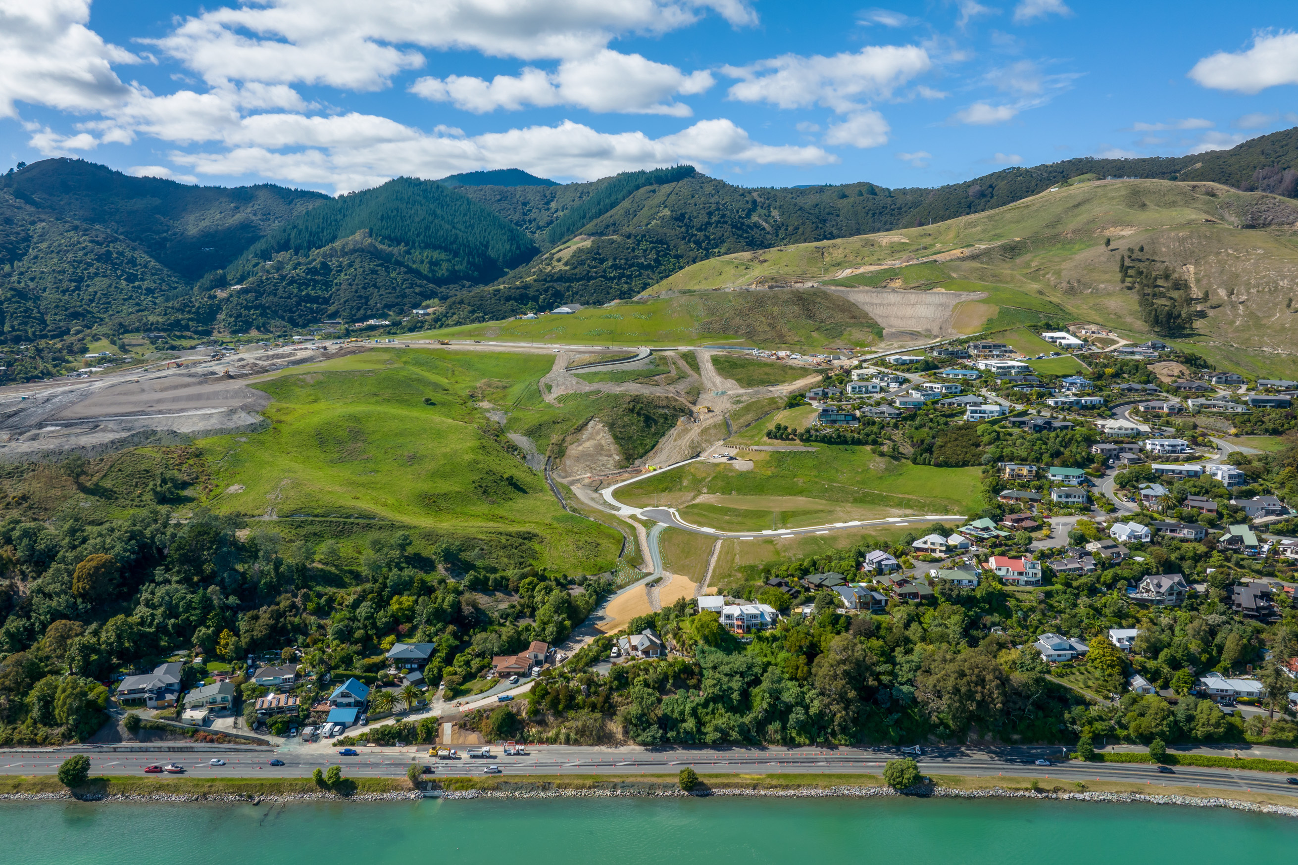
Slope Stability: Addressing and Preventing Landslide Risks
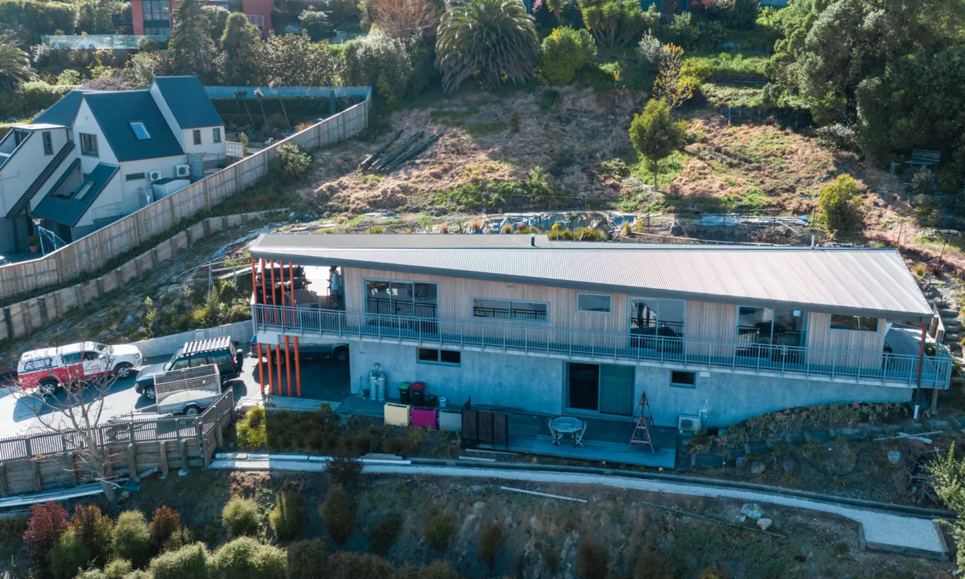
Building on sloped land offers unmatched views and elevated design opportunities, but hillside terrain requires specialised care. The natural beauty of elevated property often comes with underlying geological considerations that must be managed long before earthworks or construction begin.
22 Sept 2026 | 4 min read
Without proper planning, heavy rainfall events, seismic activity, or unengineered site alterations (i.e.. cut and fill) can transform stable ground into a severe liability.
Partnering early with an experienced geotechnical engineering team allows developers, contractors, and landowners to identify risks early, protect structural integrity, and ensure long-term stability.
What causes a slope to become unstable?
A slope becomes unstable when driving forces (gravity and added weight) exceed resisting forces (the shear strength and cohesion of soil and rock). This imbalance occurs when natural triggers or human activities weaken the ground's internal strength or increase the downward force acting on the hill.

Several key triggers can disrupt this delicate balance:
1. Water Saturation and Pore Water Pressure:
Heavy rainfall or poor drainage increases overall soil weight while raising pore water pressure, which reduces friction between soil particles and causes shear strength loss.
2. Unengineered Earthworks and Excavation
Excavating the base (toe) of a hill removes essential lateral support, whilst adding uncompacted fill at the top (crest) increases driving weight on the slope face.
3. Vegetation Clearance and Deforestation
Removing trees and deep-root systems eliminates natural soil anchorage and alters groundwater drainage, leading to surface layer instability.
4. Seismic Activity and Ground Shaking
Earthquakes generate rapid dynamic loads that momentarily exceed soil shear strength, triggering landslides, rockfalls, or soil liquefaction.
How do you tell if a slope is going to fail?
In many cases, ground instability provides subtle warnings before a major movement takes place. Recognising these early warning signs during site visits can prevent catastrophic failure and inform timely intervention.
Surface Indicators
- Tension Cracks: Fresh cracks opening in the soil along or near the top of a slope.
- Hummocky Ground: Undulating, uneven turf or terracing that indicates upper soil layers are creeping downhill.
- Depressions: Sudden localized sinking or settlement in lawns, driveways, or access tracks.
Structural Indicators
- Foundation Movement: New or expanding cracks in concrete slabs, retaining structures, or perimeter walls.
- Binding Frames: Interior or exterior doors and windows that suddenly stick or fail to close smoothly.
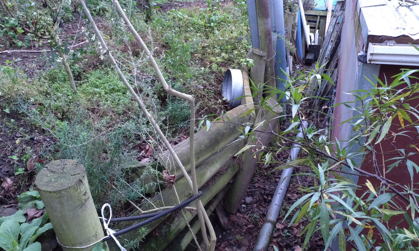
- Retaining Wall Tilting: Retaining structures leaning outward or separating from attached side walls.
Environmental Indicators
- Unusual Seepage: Water springing out from the face or toe of a slope where ground was previously dry.
- Leaning Features: Fences, retaining posts, trees, or utility poles slanting downhill.
If you observe these signs on a developed site or following a severe weather event, professional land damage assessments are essential to determine the root cause and establish immediate stabilisation steps.
The Geotechnical Assessment: What to Expect
Understanding slope behaviour requires a comprehensive, step-by-step scientific approach. A professional assessment evaluates both surface topography and sub-surface conditions to model potential slope hazards accurately.
1. Desktop Research & Topographic Mapping
Before stepping onto the site, engineers analyse regional hazard maps, historical aerial photography, and geological records. This initial phase is sometimes paired with a detailed topographic survey to capture precise contours, existing slopes, and site features.
2. On-Site Investigation
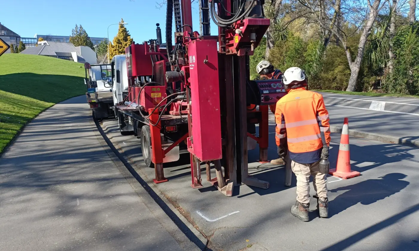
Engineers conduct a tailored geotechnical site investigation to physically examine sub-surface conditions. This phase may involve drilling boreholes, excavating test pits, and performing Cone Penetration Testing (CPT) to map soil strata and measure ground resistance.
3. Soil & Subsoil Testing
At the severe end of land instability, samples extracted from the field undergo comprehensive soil testing to measure critical properties such as density, permeability, moisture content, and shear strength. Inclinometers may also be installed in boreholes to monitor ground movement over time.
4. Computer Modelling & Factor of Safety
Engineers utilise specialised software to construct cross-sectional slope models. These models calculate the Factor of Safety (FoS) under static conditions and simulated seismic or heavy rainfall events. Factors of Safety are defined as the ratio between the forces that help keep the slope stable and the forces that destabilise it. Hence, a slope that is in perfect equilibrium will have a FoS of 1. The greater the number, the more stable it is.
A Factor of Safety above 1.5 is typically required for permanent residential developments.
5. Reporting & Recommendations
The final output is a detailed geotechnical report outlining foundation parameters, earthwork recommendations, slope setback limits, and drainage requirements.
How can landslide risk be prevented or reduced?
Preventing slope failure requires tailored engineering solutions that address the specific triggers identified during site investigations. Effective landslide risk reduction generally combines surface management with structural stabilisation.
Water & Drainage Control (The First Line of Defence)
Because water is the primary cause of slope failure, controlling surface runoff and groundwater is paramount. When thinking of the Factor of Safety ratio, these measures try to improve the forces acting against stability.
- Cut-off Drains: Surface swales (sometimes with subsurface drains) diverted away from slope crests to prevent surface water from soaking into vulnerable ground.
- Subsurface Drainage (French Drains): Perforated subsoil pipes or deep trench drains installed to intercept groundwater and lower pore water pressure.
Earthworks & Regrading
Modifying the profile of a slope can rebalance forces:
- Slope Flattening: Reducing the overall steepness of the gradient.
- Benching: Cutting a series of horizontal steps into the slope to break up continuous runoff and lower driving forces.
Structural Engineering Retaining Methods
When thinking of the Factor of Safety ratio, these structural measures try to improve the forces improving stability.
Where space or steepness prevents simple regrading and simple dewatering is insufficient, engineered structures provide mechanical resistance:
- Soil Nailing & Ground Anchors: Steel rods grouted deep into stable rock or soil layers to pin upper slopes in place.
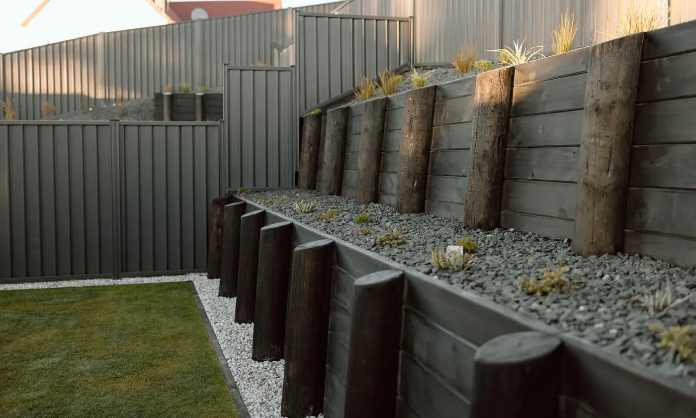
- Retaining Walls: There are many types of retaining structures but all aim to support the slope in some form or another.
These are highly specialised structures which require a geotechnical engineer with a background in structural engineering. A structural engineer alone is likely to miss-characterise the soil component of the equation, while a geological engineer is unlikely to calculate an adequate structural element.

Do you need a geotechnical report to build on a slope?
In New Zealand, yes. A geotechnical report is almost always mandatory when building on sloped land or within an identified natural hazard area. Local councils require technical proof from a Chartered Professional Engineer (CPEng) confirming that the land is suitable for development and that building work will not accelerate or trigger land instability.
Key Compliance & Regulatory Requirements
- NZ Building Code Clause B1 (Structure): Requires all site work and structural elements to withstand physical loads, including ground movement and slope pressures.
- Building Act 2004 (Sections 71–74): Dictates that councils must refuse building consents on land subject to natural hazards (such as slippage, erosion, or subsidence) unless adequate mitigation is proven.
- Resource Management Act (RMA) & Local District Plans: District plans mandate geotechnical slope hazard evaluations before granting Resource Consents for developments on steep terrain.
Beyond meeting council consenting criteria, obtaining early geotechnical input safeguards your financial investment.
Identifying soil constraints during the initial planning phase allows foundation systems to be optimised early, preventing unexpected structural failure, costly redesigns, or uninsurable site liabilities down the track.
Safeguard Your Sloped Project with Eliot Sinclair
Proactive slope evaluation is significantly faster and more cost-effective than managing a reactive landslip remediation. Whether you are developing a commercial subdivision, upgrading infrastructure, or designing a bespoke home on a steep hill site, expert engineering ensures your project stands on solid ground.
Planning a build on sloped terrain or concerned about ground movement on your property? Get in touch with our team at Eliot Sinclair to schedule an initial site assessment with our geotechnical specialists.
More Insights
The Role of Geotechnical Engineering in Building Consent
24 Sept 2026
Ground conditions you can't see from the surface…
Slope Stability
22 Sept 2026
Building on sloped land offers unmatched views…
Geotechnical Engineering in Road Construction
27 Aug 2026
Every civil contractor and property developer…