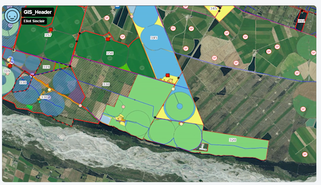
Transforming Canterbury Irrigation Management with GIS Mapping
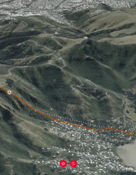
Waimakariri Irrigation Limited (WIL) operates in North Canterbury, delivering irrigation water to approximately 367 farms across its scheme area. WIL assist its clients in preparing Farm Environment Plans (FEPs) reporting land use, irrigation practices and compliance from data produced through the supply of their irrigation services.
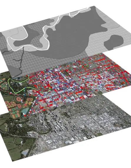
Traditionally, WIL managed these records in non-visual formats that were difficult to work with at scale. Eliot Sinclair was engaged to design a system that could consolidate and visualise this data, making it easier for WIL to manage, track and present information across its network.
Client
Waimakariri Irrigation LimitedServices
- GIS
The challenge
Our client’s team was working with vast amounts of spatial and attribute data supplied in inconsistent formats. Managing this information for hundreds of farms was time-consuming and prone to errors. Their goal was to create a central, visual platform for storing and accessing farm boundaries, irrigated areas and scheme infrastructure, with the ability to drill into asset attributes as required.
Accuracy and reliability were also a priority, the solution would need to identify data overlaps or inconsistencies, allowing WIL to validate and improve its dataset over time.
The solution
Eliot Sinclair set up a secure, cloud-based GIS platform with layered mapping of farm boundaries, and corresponding scheme assets, along with publicly available data that would be useful when developing FEP’s. We imported and cleaned WIL’s existing datasets, applied data validation checks to identify errors, and established unique attributes for each asset type, while maintaining a logical naming convention between the layers that shared attributes.
The system was configured with tailored permissions so different users could access only the data relevant to their role. Over time, the platform has expanded to include additional layers at our client’s request, providing a single source of truth for operational and compliance purposes.
After providing training to our client, they now maintain the system in-house, ensuring long-term sustainability while we continue to provide technical support as needed. The outcome is a highly visual, accurate and accessible mapping system that has improved WIL’s data quality and operational efficiency. Seeing the benefits of an integrated, visual data system we have continued to work with the client to create a smart asset management tool.